


Looking from the exit into the RV park. Notice
Topper and Red Ryder on the left under the tree.

The building in the foreground is the office,
and the red building is the utility barn.

Looking back into the park from the huge expanse of lawn.
This morning, we unloaded Topper from Red Ryder. That makes sightseeing ever so much easier. We left the park and headed west on Hwy 26 toward picture gorge, a narrow winding gorge through which Rattlesnake Creek (don't you love that name?) runs. The gorge features 15 layers of basalt that were laid down during an era of "basalt flooding" when the earth opened up and poured forth magma. But more about that later.
Before we got to the gorge, we turned off the road to see the Mascall Overlook. This is a plateau that gives an elevated view of some of the fossil fields in the area.

Looking East from the Overlook.

Looking west. Notice the striped rock below. This is an exposed area
of layer upon layer of volcanic ash that buried some of the creatures that became fossils.

The very flat tops on these hills are volcanic deposits over the
top of volcanic ash and other sedimentary layers.

The dark area in the center between the hills is Picture Gorge.

On the way to the Gorge, we drove along Rattlesnake Creek. Notice the layering of the basalt.

We arrived at the Thomas Condon Paleontology Center.
The Condon Paleontology Center is named for a clergyman from The Dalles who was also an amateur geologist. He was the first to realize the importance of what later became known as the John Day Fossil Beds. There is a statement attributed to him on one of the signs in the Center that says something like, 'The same God Who made all of this is the One Who made the hills around Jerusalem.' He goes on to say that the church has nothing to fear from the truth of creation being exposed. Unfortunately, the Center seems to have rejected Condon's creationist viewpoint and is heavily rooted in the Evolutionist/Old Earth propaganda that is so widespread in our government institutions of learning.

This is Sheep Rock, so named for the myriad sheep that used to
roam this area when the settlers set about sheep farming.
The John Day Fossil Beds National Monument exists as three "campuses," if you will: The Sheep Rock Unit, The Painted Hills Unit, and The Clarno Unit. We obviously visited the Sheep Rock Unit. That is where the Condon Center is located. Part of the Sheep Rock Unit includes the Blue Basin area, which is a
natural formation made up of layers of volcanic ash, in which are buried
thousands of fossilized animals and plants.

Looking back down the road from the parking lot of the Blue Basin Area.
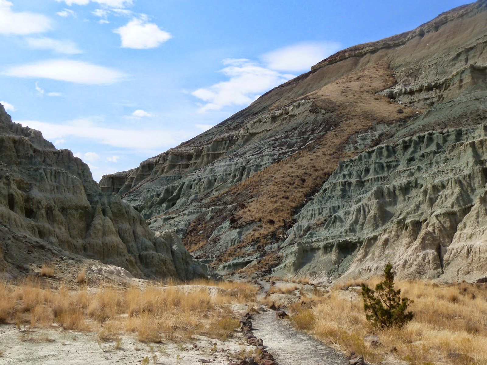
There is a trail that circumnavigates the basin. Another trail leads directly into a natural "amphitheater" carved out of the rock. Since it was shorter, we took the latter trail. The path follows a creek bed that obviously has water in it at times, but it was bone dry today. The colors of the rocks are incredible and impossible to capture on film.

Along the trail, you can begin to see the blue-green rock that gives the basin its name.

The blue-green material looks very much like the volcanic ash I remember sweeping up after the 1980 Mt. St. Helens eruption, only it is compacted into solid layers. The creek bed is covered with powdery residue of this material. The compacted material, though hard to the touch is quite friable, which is probably why it is so easy to find the fossils buried in it. It simply chips away, almost with finger pressure. My conclusion was that, in spite of the claims that it is 29 million years old, anything that friable would have washed away long before now, if it had really been there that long.

I found the most beautiful blue flower along the path.
Here we are beginning to enter the amphitheater area.

Standing in the observation area in the center of the amphitheater,
I turned around and took three pictures moving from right to left.
The sequence begins with this shot and includes the next two photos.


As I mentioned, it is impossible to fully capture the beauty and grandeur of this place on film. I suggest you click on the photos to enlarge them. It may help to enhance my meager photographic efforts.
We left the Blue Basin Area and headed further north on Hwy 19. There is one more section to the Sheep Rock Unit. It is called the Foree Area. It includes a small picnic ground and a couple of short (1/4 mile) trails. We stopped in the parking lot and could see that the paths lead to more of the incredible blue stones. It was warm, so we decided to move on.
Continuing north we followed the John Day River through a beautiful valley containing ranches and farms and bracketed by the breathtaking hills with their blues and reds and golds provided by various kinds of rock. Eventually, we arrived at Kimberly, a "town" that once was thriving but now appears to comprise a Post Office/Store and an office building for the gigantic Longview Ranch, which we passed in the valley. Oh, yes, Kimberly sits at the junction of the main and north forks of the John Day river and the junction of Hwy 19 and Hwy 402, which goes east to Monument and Long Creek.

On our way back to Dayville, we passed Cathedral Rock. It is breathtaking in person.
Our evening brought a surprise thunderstorm that had our main dog, Pogo, panting and drooling from fright, while our small, auxiliary dog, Lulu, snoozed on the couch. Gotta love your kids and their different personalities!
No comments:
Post a Comment